Portal:Tropical cyclones
The Tropical Cyclones Portal

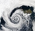
A tropical cyclone is a storm system characterized by a large low-pressure center, a closed low-level circulation and a spiral arrangement of numerous thunderstorms that produce strong winds and heavy rainfall. Tropical cyclones feed on the heat released when moist air rises, resulting in condensation of water vapor contained in the moist air. They are fueled by a different heat mechanism than other cyclonic windstorms such as Nor'easters, European windstorms and polar lows, leading to their classification as "warm core" storm systems. Most tropical cyclones originate in the doldrums, approximately ten degrees from the Equator.
The term "tropical" refers to both the geographic origin of these systems, which form almost exclusively in tropical regions of the globe, as well as to their formation in maritime tropical air masses. The term "cyclone" refers to such storms' cyclonic nature, with anticlockwise rotation in the Northern Hemisphere and clockwise rotation in the Southern Hemisphere. Depending on its location and intensity, a tropical cyclone may be referred to by names such as "hurricane", "typhoon", "tropical storm", "cyclonic storm", "tropical depression" or simply "cyclone".
Types of cyclone: 1. A "Typhoon" is a tropical cyclone located in the North-west Pacific Ocean which has the most cyclonic activity and storms occur year-round. 2. A "Hurricane" is also a tropical cyclone located at the North Atlantic Ocean or North-east Pacific Ocean which have an average storm activity and storms typically form between May 15 and November 30. 3. A "Cyclone" is a tropical cyclone that occurs in the South Pacific and Indian Oceans.
Selected named cyclone -
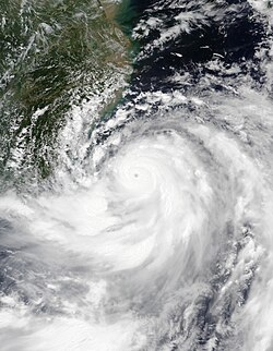
Typhoon Gaemi, known in the Philippines as Super Typhoon Carina, was a powerful and destructive tropical cyclone which impacted East China, Taiwan, and the Philippines in late July 2024. Gaemi, which means ant in Korean, the third named storm and second typhoon of the annual typhoon season, formed as a tropical depression east of Palau on July 19. Owing to favorable environmental conditions, the typhoon intensified and reached its peak with ten-minute maximum sustained winds of 165 km/h (105 mph), and a central atmospheric pressure of 935 hPa (27.61 inHg). With one-minute sustained winds at 230 km/h (145 mph), Gaemi was classified as a Category 4-equivalent typhoon. The storm then turned north-northwestward, along the western periphery of a subtropical ridge. After stalling and executing a tight counter-clockwise loop near the coast, Gaemi slightly weakened due to land interaction before making landfall on the northeastern coast of Taiwan on July 24. It emerged over the Taiwan Strait just six hours after landfall. Gaemi made landfall in China as a minimal tropical storm in the Xiuyu District of Putian in Fujian Province. Once inland, the system weakened to a tropical depression by July 26 and continued tracking the system until it dissipated on July 29.
Together with the southwest monsoon and Tropical Storm Prapiroon, heavy rains were reported over southern and northern Luzon, triggering widespread flash floods in various areas of the region. The monsoon enhanced by Gaemi's impact on Luzon led to comparisons to 2009's Typhoon Ketsana. The oil tanker MT Terra Nova, carrying around 1.5 million liters of industrial fuel, capsized and sank in 34 m (112 ft) depth of water in Manila Bay off the coast of Limay, Bataan. In Japan, the island of Yonaguni recorded wind speeds of up to 180 km/h (110 mph). In Indonesia, large waves of up to 2.5 m (8.2 ft) in height affected the Molucca Sea, North Natuna Sea, Natuna Sea, and the areas between the Sitaro Islands and Bitung, and between the Sangihe Islands and Talaud Islands. A maximum rainfall accumulation of 512.8 mm (20.19 in) was observed in Luoyuan County in Fujian Province. The remnants of Gaemi also hit North Korea, where up to 4,000 may have died. North Korean state media did not provide figures on casualties. In total, the typhoon killed at least 152 people, injured 924 others, left 42 missing, and caused US$4.57 billion in damages. (Full article...)
Selected article -
The 1943 Surprise Hurricane was the first hurricane to be entered by a reconnaissance aircraft. The first tracked tropical cyclone of the 1943 Atlantic hurricane season, this system developed as a tropical storm while situated over the northeastern Gulf of Mexico on July 25. The storm gradually strengthened while tracking westward and reached hurricane status late on July 26. Thereafter, the hurricane curved slightly west-northwestward and continued intensifying. Early on July 27, it became a Category 2 hurricane on the modern-day Saffir–Simpson hurricane wind scale and peaked with winds of 105 mph (165 km/h). The system maintained this intensity until landfall on the Bolivar Peninsula in Texas late on July 27. After moving inland, the storm initially weakened rapidly, but remained a tropical cyclone until dissipating over north-central Texas on July 29.
Because the storm occurred during World War II, information and reports were censored by the government of the United States and news media. Advisories also had to be cleared through the Weather Bureau office in New Orleans, resulting in late releases. This in turn delayed preparations ahead of the storm. In Louisiana, the storm produced gusty winds and heavy rains, though no damage occurred. The storm was considered the worst in Texas since the 1915 Galveston hurricane. Wind gusts up to 132 mph (212 km/h) were reported in the Galveston-Houston area. Numerous buildings and houses were damaged or destroyed. The storm caused 19 fatalities, 14 of which occurred after two separate ships sank. Overall, damage reached approximately $17 million (equivalent to $309 million in 2024). (Full article...)
Selected image -
Selected season -

The 1994 Pacific hurricane season was the final season of the eastern north Pacific's consecutive active hurricane seasons that started in 1982. The season officially started on May 15, 1994, in the eastern Pacific, and on June 1, 1994, in the central Pacific, and lasted until November 30, 1994. These dates conventionally delimit the period of each year when most tropical cyclones form in the northeastern Pacific Ocean. The first tropical cyclone formed on June 18, while the last system dissipated on October 26. This season, twenty-two tropical cyclones formed in the north Pacific Ocean east of the dateline, with all but two becoming tropical storms or hurricanes. A total of 10 hurricanes occurred, including five major hurricanes. The above average activity in 1994 was attributed to the formation of the 1994–95 El Niño.
Of note in this season is an unusual spree of very intense storms; the season was the first on record to see three Category 5 hurricanes, later tied in 2002 and 2018. Hurricanes Emilia, Gilma, John, and Olivia all reached a pressure below 930 millibars. Hurricane John was the farthest-traveling tropical cyclone on record at 13,180 km (8,190 mi). Elsewhere, Hurricane Rosa caused four casualties in Mexico as the basin's only landfalling tropical storm or hurricane, and later was responsible for flooding in Texas. (Full article...)
Related portals
Currently active tropical cyclones
Italicized basins are unofficial.
- North Atlantic (2025)
- No active systems
- East and Central Pacific (2025)
- No active systems
- North Indian Ocean (2025)
- No active systems
- Mediterranean (2025–26)
- No active systems
- South-West Indian Ocean (2025–26)
- No active systems
- Australian region (2025–26)
- No active systems
- South Pacific (2025–26)
- No active systems
- South Atlantic (2025–26)
- No active systems
Last updated: 05:29, 4 July 2025 (UTC)
Tropical cyclone anniversaries

July 3,
- 1963 - The final storm of the 1962–63 Southern Hemisphere tropical cyclone season dissipates to the west of New Zealand, becoming one of two Southern Hemisphere tropical cyclones on record to exist in two separate seasons.
- 1994 - Tropical Storm Alberto (pictured) made landfall near Destin, Florida. Alberto killed 32 people in total with damages of about $1 billion.

July 4,
- 1974 - Typhoon Gilda reached its peak intensity with 155 km/h (100 mph) winds before it affected Japan and South Korea, killing 128 and people causing $1.5 billion of damage.
- 2014 - Hurricane Arthur (pictured) reached its peak intensity while making landfall over in North Carolina which caused about $22.7 million in damages and only killed two people.

July 5,
- 1992 - Hurricane Darby attains peak strength with winds of 195 km/h (120 mph).
- 2005 - Hurricane Cindy (pictured) made landfall in southeast Louisiana as a minimal hurricane causing flooding and a severe power outage in New Orleans. Cindy caused a total of $320 million of damage.
- 2007 - Tropical Storm Toraji makes landfall over in South China as a weak tropical storm causing US$9.7 million in damages.
Did you know…


- …that the Joint Typhoon Warning Center considers that Typhoon Vera (pictured) of 1986 is actually two distinct systems, formed from two separated low-level circulations?
- …that Cyclone Freddy (track pictured) in 2023 was the longest-lasting tropical cyclone recorded?
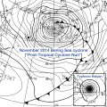
- …that the typhoons of 2024—Yinxing, Toraji, Usagi, and Man-yi (pictured)—made history as the first recorded instance since 1951 of four tropical cyclones coexisting in November?
- …that Hurricane Otis (pictured) in 2023 was the first Pacific hurricane to make landfall at Category 5 intensity and surpassed Hurricane Patricia as the strongest landfalling Pacific hurricane on record?
General images -

413 known tropical and subtropical cyclones have affected the U.S. state of North Carolina. Due to its location, many hurricanes have hit the state directly, and numerous hurricanes have passed near or through North Carolina in its history; the state is ranked fourth, after Florida, Texas, and Louisiana, in the number of cyclones that produced hurricane-force winds in a U.S. state. (Full article...)
Topics
Subcategories
Related WikiProjects
WikiProject Tropical cyclones is the central point of coordination for Wikipedia's coverage of tropical cyclones. Feel free to help!
WikiProject Weather is the main center point of coordination for Wikipedia's coverage of meteorology in general, and the parent project of WikiProject Tropical cyclones. Three other branches of WikiProject Weather in particular share significant overlaps with WikiProject Tropical cyclones:
- The Non-tropical storms task force coordinates most of Wikipedia's coverage on extratropical cyclones, which tropical cyclones often transition into near the end of their lifespan.
- The Floods task force takes on the scope of flooding events all over the world, with rainfall from tropical cyclones a significant factor in many of them.
- WikiProject Severe weather documents the effects of extreme weather such as tornadoes, which landfalling tropical cyclones can produce.
Things you can do
 |
Here are some tasks awaiting attention:
|
Wikimedia
The following Wikimedia Foundation sister projects provide more on this subject:
-
Commons
Free media repository -
Wikibooks
Free textbooks and manuals -
Wikidata
Free knowledge base -
Wikinews
Free-content news -
Wikiquote
Collection of quotations -
Wikisource
Free-content library -
Wikiversity
Free learning tools -
Wikivoyage
Free travel guide -
Wiktionary
Dictionary and thesaurus
