Portal:Virginia
The Virginia Portal  Virginia, officially the Commonwealth of Virginia, is a state in the Southeastern and Mid-Atlantic regions of the United States between the Atlantic Coast and the Appalachian Mountains. The state's capital is Richmond and its most populous city is Virginia Beach. Its most populous subdivision is Fairfax County, part of Northern Virginia, where slightly over a third of Virginia's population of more than 8.8 million live. Eastern Virginia is part of the Atlantic Plain, and the Middle Peninsula forms the mouth of the Chesapeake Bay. Central Virginia lies predominantly in the Piedmont, the foothill region of the Blue Ridge Mountains, which cross the western and southwestern parts of the state. The fertile Shenandoah Valley fosters the state's most productive agricultural counties, while the economy in Northern Virginia is driven by technology companies and U.S. federal government agencies. Hampton Roads is also the site of the region's main seaport and Naval Station Norfolk, the world's largest naval base. (Full article...) Selected article
Sailing south from New York with 19 ships of the line, Graves arrived at the mouth of the Chesapeake early on 5 September to see de Grasse's fleet of 24 ships of the line at anchor in the bay. De Grasse sailed out to meet Graves. In a two-hour engagement after hours of manoeuvring, the lines of the two fleets did not completely meet nor fully engage. The battle was consequently fairly evenly matched. The battle was tactically inconclusive but strategically a major defeat for the British, since it prevented the Royal Navy from reinforcing or evacuating the blockaded forces of Lieutenant General Lord Cornwallis at Yorktown. As a result, Cornwallis surrendered his army after the Siege of Yorktown, resulting in negotiations that eventually resulted in peace and British recognition of the independent United States of America. Selected biography
In 1920, Anderson was institutionalized in a mental hospital after a suicide attempt in Berlin. In March 1922, claims that Anderson was a Russian grand duchess first received public attention. Most members of Grand Duchess Anastasia's family and those who had known her, including court tutor Pierre Gilliard, said Anderson was an impostor but others were convinced she was Anastasia. In 1927, a private investigation identified Anderson as Franziska Schanzkowska, a Polish factory worker with a history of mental illness. After a lawsuit lasting many years, the German courts ruled that Anderson had failed to prove she was Anastasia, but through media coverage, her claim gained notoriety. She emigrated to the United States in 1968, and shortly before the expiry of her visa married Jack Manahan, a Virginia history professor who was later characterized as "probably Charlottesville's best-loved eccentric". DNA tests on a lock of Anderson's hair and surviving medical samples of her tissue showed that Anderson's DNA did not match that of the Romanov remains or that of living relatives of the Romanovs. Most scientists, historians and journalists who have discussed the case accept that Anderson and Schanzkowska were the same person. This month in Virginia history
Random Virginia articleA random generator will select an article about… 
(note: generator may be slow) Things you can do
Tasks
Selected image_meadow_pavilion.jpg) The Meadow Pavilion at the Wolf Trap National Park for the Performing Arts, Fairfax County, Virginia Did you know -
Fact sheet
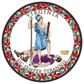
State symbols:
Government
Related portalsVirginia topicsSubcategoriesSelect [+] to view subcategories
Associated WikimediaThe following Wikimedia Foundation sister projects provide more on this subject:
Discover Wikipedia using portals |