Michigan consists of two peninsulas: the heavily forested Upper Peninsula (commonly called "the U.P."), which juts eastward from northern Wisconsin, and the more populated Lower Peninsula, stretching north from Ohio and Indiana. The peninsulas are separated by the Straits of Mackinac, which connects Lake Michigan and Lake Huron, and are linked by the 5-mile-long Mackinac Bridge along Interstate 75. Bordering four of the five Great Lakes and Lake St. Clair, Michigan has the longest freshwater coastline of any U.S. political subdivision, measuring 3,288 miles. The state ranks second behind Alaska in water coverage by square miles and first in percentage, with approximately 42%, and it also contains 64,980 inland lakes and ponds.
The Great Lakes region has largely been inhabited for thousands of years by Indigenous peoples such as the Ojibwe, Odawa, Potawatomi, and Wyandot.
Some people contend that the region's name is derived from the Ojibwe word ᒥᓯᑲᒥ (mishigami), meaning "large water" or "large lake". While others say that it comes from the Mishiiken Tribe of Mackinac Island, also called Michinemackinawgo by Ottawa historian Andrew Blackbird, whose surrounding lands were referred to as Mishiiken-imakinakom, later shortened to Michilimackinac.
In the 17th century, French explorers claimed the area for New France. French settlers and Métis established forts and settlements.
After France's defeat in the French and Indian War in 1762, the area came under British control and later the U.S. following the Treaty of Paris (1783), though control remained disputed with Indigenous tribes until treaties between 1795 and 1842. The area was part of the larger Northwest Territory; the Michigan Territory was organized in 1805. (Full article...)
In a Major League Baseball game played on June 2, 2010, at Detroit's Comerica Park, Detroit Tigers pitcher Armando Galarraga nearly became the 21st pitcher in Major League Baseball history to throw a perfect game. Facing the Cleveland Indians, Galarraga retired the first 26 batters he faced. His bid for a perfect game was ruined one out short when first-base umpire Jim Joyce incorrectly ruled that Indians batter Jason Donald reached first base safely on a ground ball. Galarraga instead finished with a one-hit shutout in a 3–0 victory. He faced 28 batters and threw 88 pitches (67 strikes and 21 balls), striking out three. The game is sometimes referred to as the "28-out perfect game", the "almost perfect game", the "extra perfect game", the "imperfect game", or simply the "Galarraga game".
Joyce was tearful and apologetic upon meeting with Galarraga after the game after realizing that he had made an incorrect call. Galarraga was forgiving and understanding of the mistake, telling reporters after the game, "Nobody's perfect." Many others throughout Major League Baseball subsequently voiced their support for Joyce. The sportsmanship demonstrated by Galarraga and Joyce earned them widespread praise for their handling of the incident. (Full article...)
Miličević performing in Baton Rouge, Louisiana in February 2010
Tomislav "Tomo" Miličević (Croatian pronunciation:[tǒːmomilǐːt͡ʃevit͡ɕ]; born September 3, 1979) is a Bosnian Croat-American musician and record producer. He was the lead guitarist of the rock band Thirty Seconds to Mars from 2003 to 2018. Born in Sarajevo but raised in the United States, Miličević moved to Troy, Michigan, in the early 1980s, where he became active in the local heavy metal scene and played in a number of bands, co-founding Morphic. In 2003, he joined Thirty Seconds to Mars, with whom he achieved worldwide recognition in the mid-2000s after recording the band's second album A Beautiful Lie (2005). Its full-length follow-ups, This Is War (2009) and Love, Lust, Faith and Dreams (2013), received further critical and commercial success.
Miličević has also worked as a collaborator and music producer. Throughout the 2010s, he was featured on a recording with Dommin and collaborated with Ivy Levan on a number of releases, including Introducing the Dame (2013) and No Good (2015). Miličević has experimented with various guitar effects and introduced influences from several genres of music into his own style. (Full article...)
Image 5Union members occupying a General Motors body factory during the Flint Sit-Down Strike of 1937 which spurred the organization of militant CIO unions in auto industry (from History of Michigan)
Image 19A map of Michigan by Henry Schenck Tanner, published in 1842, showing such county names as "Negwegon County," "Okkuddo County," and "Unwattin County," prior to an 1843 legislative action renaming sixteen counties in northern Michigan (from History of Michigan)
Image 33Treaty of Paris, by Benjamin West (1783), an unfinished painting of the American diplomatic negotiators of the Treaty of Paris which brought official conclusion to the Revolutionary War and gave possession of Michigan and other territory to the new United States (from Michigan)
Image 41Detroit in the mid-twentieth century. At the time, the city was the fourth-largest U.S. metropolis by population, and held about one-third of the state's population. (from Michigan)
Image 42Cora Reynolds Anderson became the first woman elected to the House of Representatives in Michigan in 1925. (from History of Michigan)


_(cropped).jpg)
.jpg)


.jpg)
,_Dearborn,_Michigan_(14200507431).jpg)
.png)


.jpg)


.jpg)


.jpg)


_001.jpg)
.jpg)


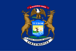 The Flag of Michigan
 The Seal of Michigan
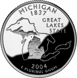 State Quarter – Released in 2004


 Commons
 Wikibooks
 Wikidata
 Wikinews
 Wikiquote
 Wikisource
 Wikiversity
 Wikivoyage
 Wiktionary


