Portal:Maps
| Main page | Maps |
The Maps and Cartography Portal

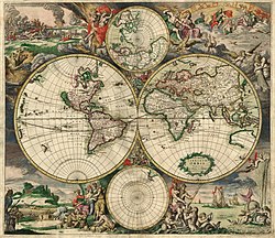
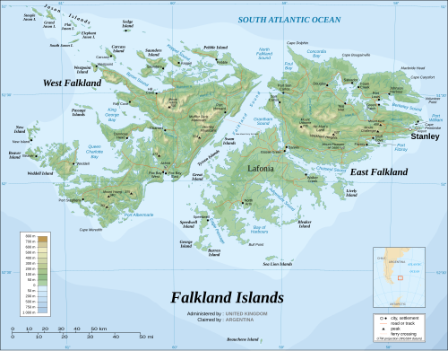
A map is a symbolic depiction of interrelationships, commonly spatial, between things within a space. A map may be annotated with text and graphics. Like any graphic, a map may be fixed to paper or other durable media, or may be displayed on a transitory medium such as a computer screen. Some maps change interactively. Although maps are commonly used to depict geographic elements, they may represent any space, real or fictional. The subject being mapped may be two-dimensional such as Earth's surface, three-dimensional such as Earth's interior, or from an abstract space of any dimension.
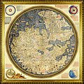
Maps of geographic territory have a very long tradition and have existed from ancient times. The word "map" comes from the medieval Latin: Mappa mundi, wherein mappa meant 'napkin' or 'cloth' and mundi 'of the world'. Thus, "map" became a shortened term referring to a flat representation of Earth's surface. (Full article...)
Cartography (/kɑːrˈtɒɡrəfi/) is the study and practice of making and using maps. Combining science, aesthetics and technique, cartography builds on the premise that reality (or an imagined reality) can be modeled in ways that communicate spatial information effectively. (Full article...)
Selected article -

The Piri Reis map is a world map compiled in 1513 by the Ottoman admiral and cartographer Piri Reis. Approximately one third of the map survives, housed in the Topkapı Palace in Istanbul. After the empire's 1517 conquest of Egypt, Piri Reis presented the 1513 world map to Ottoman Sultan Selim I (r. 1512–1520). It is unknown how Selim used the map, if at all, as it vanished from history until its rediscovery centuries later. When rediscovered in 1929, the remaining fragment garnered international attention as it includes a partial copy of an otherwise lost map by Christopher Columbus.
The map is a portolan chart with compass roses and a windrose network for navigation, rather than lines of longitude and latitude. It contains extensive notes primarily in Ottoman Turkish. The depiction of South America is detailed and accurate for its time. The northwestern coast combines features of Central America and Cuba into a single body of land. Scholars attribute the peculiar arrangement of the Caribbean to a now-lost map from Columbus that merged Cuba into the Asian mainland and Hispaniola with Marco Polo's description of Japan. This reflects Columbus's erroneous claim that he had found a route to Asia. The southern coast of the Atlantic Ocean is most likely a version of Terra Australis. (Full article...)
General images -
Selected quote
| “ | Typical Englishman John Smith is more concerned about David Beckham's fitness than his own wife's. Typical Chinese man Som Young Guy is not trying to grow the population of his country for over one month. Typical German Jurgen wants to check from the map that where about in Europe the cheating Uruguay is located. | ” |
| — Aki Riihilahti | ||
Related portals
Related WikiProjects
Selected biography -
Shen Kuo (Chinese: 沈括; 1031–1095) or Shen Gua, courtesy name Cunzhong (存中) and pseudonym Mengqi (now usually given as Mengxi) Weng (夢溪翁), was a Chinese polymath, scientist, and statesman of the Song dynasty (960–1279). Shen was a master in many fields of study including mathematics, optics, and horology. In his career as a civil servant, he became a finance minister, governmental state inspector, head official for the Bureau of Astronomy in the Song court, Assistant Minister of Imperial Hospitality, and also served as an academic chancellor. At court his political allegiance was to the Reformist faction known as the New Policies Group, headed by Chancellor Wang Anshi (1021–1085).
In his Dream Pool Essays or Dream Torrent Essays (夢溪筆談; Mengxi Bitan) of 1088, Shen was the first to describe the magnetic needle compass, which would be used for navigation (first described in Europe by Alexander Neckam in 1187). Shen discovered the concept of true north in terms of magnetic declination towards the north pole, with experimentation of suspended magnetic needles and "the improved meridian determined by Shen's [astronomical] measurement of the distance between the pole star and true north". This was the decisive step in human history to make compasses more useful for navigation, and may have been a concept unknown in Europe for another four hundred years (evidence of German sundials made circa 1450 show markings similar to Chinese geomancers' compasses in regard to declination). (Full article...)
Selected picture

Did you know
- ... that Maki Narukido researched the characters' travel times in her manga The End of the World With You using Google Maps?
- ... that DeepStateMap.Live, an interactive map of the Russian invasion of Ukraine, received up to 120,000 visitors in 30 minutes during the Battle of Izium in the 2022 Kharkiv counteroffensive?
- ... that Kathryn Maple won the Sunday Times Watercolour Competition twice in three years?
- ... that the Canadian League for Peace and Democracy organized a 10,000-person rally at Maple Leaf Gardens in Toronto to protest a 2,500-person fascist rally?
- ... that the 100 gecs tree was listed as a "place of worship" on Google Maps?
Topics
Map - Atlas - Geography - Topography
Cartography: Cartographers - History of cartography - Ancient world maps - World maps - Compass rose - Generalization - Geographic coordinate system - Geovisualization - Relief depiction - Scale - Terra incognita - Planetary cartography
Map projection: Azimuthal equidistant - "Butterfly" - Dymaxion - Gall–Peters - General Perspective - Goode homolosine - Mercator - Mollweide - Orthographic - Peirce quincuncial - Robinson - Sinusoidal - Stereographic
Maps: Animated mapping - Cartogram - Choropleth map - Estate map - Geologic map - Linguistic map - Nautical chart - Pictorial map - Reversed map - Road atlas - Thematic map - Topographic map - Weather map - Web mapping - World map
Map examples
World

Historical

Thematic
Geographic

Political

Nautical
Categories
Things you can do
|
Here are some Geography related tasks you can do:
|
Atlases and maps of the world at Wikimedia Commons
Associated Wikimedia
The following Wikimedia Foundation sister projects provide more on this subject:
-
Commons
Free media repository -
Wikibooks
Free textbooks and manuals -
Wikidata
Free knowledge base -
Wikinews
Free-content news -
Wikiquote
Collection of quotations -
Wikisource
Free-content library -
Wikiversity
Free learning tools -
Wiktionary
Dictionary and thesaurus


