Slochteren
Slochteren | |
|---|---|
Village and former municipality | |
 Fraeylemaborg in Slochteren | |
 Flag  Coat of arms | |
.svg) Location in Groningen | |
| Coordinates: 53°13′N 6°48′E / 53.217°N 6.800°E | |
| Country | Netherlands |
| Province | Groningen |
| Municipality | Midden-Groningen |
| Area | |
• Total | 16.86 km2 (6.51 sq mi) |
| Elevation | −1 m (−3 ft) |
| Population (2021)[1] | |
• Total | 2,140 |
| • Density | 130/km2 (330/sq mi) |
| Demonym | Slochtenaar |
| Time zone | UTC+1 (CET) |
| • Summer (DST) | UTC+2 (CEST) |
| Postcode | 9621[1] |
| Area code | 0598 |
Slochteren (Dutch pronunciation: [ˈslɔxtərə(n)] ⓘ) is a village and former municipality with a population of 15,546 in the province of Groningen in the northeast of the Netherlands. On 1 January 2018, Slochteren merged with Hoogezand-Sappemeer and Menterwolde, forming the municipality Midden-Groningen.
The former municipality can be characterized as a chain of small villages dividing a mostly agricultural polder landscape, and a connected string of mostly artficial wetlands and lakes called the 'Roegwold'. An area reclaimed from farmland not too long ago in an effort to bring back a piece of local landscape mimicing a time prior to human intervention, and in doing so also providing a resting place and breeding ground for bird populations. Having an agricultural background for at least a thousand years, besides farmers and farm workers, the community houses for the most part commuters to nearby towns like Hoogezand, Groningen and Delfzijl. The mansion, or 'borg', the Fraeylemaborg (A stronghold of the local land holding Groninger nobility) is also located in Slochteren, the oldest parts of which date back to the middle ages, and so does it's distinctly long and narrow, once privately owned, forest, 'Slochterbos', housing some of the provinces oldest trees, after most had been cut down by anchient settlers.
Geography
[edit]The population centres in the former municipality are:

Topographic map of the municipality of Slochteren, June 2015
Natural gas field
[edit]Slochteren is in the center of the giant Groningen gas field, discovered in 1959, ensuring the position of the Netherlands as a major energy exporting country. The estimated gas reserves in 2009 were 2,700 km3 (650 cu mi).[3]
Gallery
[edit]-
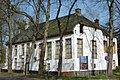
 Protestant Church
 -
 Former courthouse of Slochteren
 -
 Town hall
 -
 Former post office


References
[edit]- ^ a b c "Kerncijfers wijken en buurten 2021". Central Bureau of Statistics. Retrieved 9 April 2022.
two entries
- ^ "Postcodetool for 9621AL". Actueel Hoogtebestand Nederland (in Dutch). Het Waterschapshuis. Retrieved 3 February 2014.
- ^ NAM/Shell gas/oil website[permanent dead link]
External links
[edit] Media related to Slochteren at Wikimedia Commons
Places adjacent to Slochteren | |
|---|---|
| International | |
|---|---|
| Other | |
This Groningen location article is a stub. You can help Wikipedia by expanding it. |
This article about a natural gas field is a stub. You can help Wikipedia by expanding it. |