Road signs in China
This article's lead section may need to be rewritten. (April 2025) |

Road signs in the People's Republic of China are specified in the Guobiao standard GB 5678-2022.
China's traffic signs closely follow those used in Europe, the US, and Japan. However, China is not a signatory to the Vienna Convention on Road Signs and Signals.[1]
The road signs used in the special administrative regions of Hong Kong and Macau differ from those used in Mainland China due to colonialism.
Warning signs are triangular in shape, as in Europe, but unlike European countries, warning signs in China have a black border and a yellow background instead of a red border and a white or yellow background. This makes it one of the few countries in the world to use this type of warning sign.
Gallery
[edit]Warning signs
[edit]-
 Intersection
 -
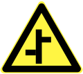 Offset junctions (Left)
 -
 Offset junctions (Right)
 -
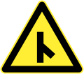
 Fork road merges (Left)
 -
 Fork road merges (Right)
 -
 Fork road ahead (Left)
 -
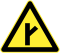 Fork road ahead (Right)
 -
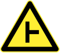
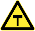 T-junction ahead
 -
 Side road junction ahead (Left)
 -
 Side road junction ahead (Right)
 -
 Roundabout
 -
 Curve (Left)
 -
 Curve (Right)
 -
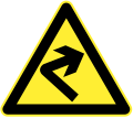
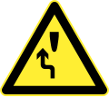
 Double curve (Right, then left)
 -
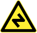
 Double curve (Left, then right)
 -
 Multiple curves
 -
 Multiple curves (Alt.)
 -
 Steep ascent
 -
 Steep descent
 -
 Continued descent
 -
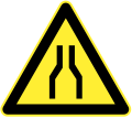 Road narrows on both sides
 -
 Road narrows on right
 -
 Road narrows on left
 -
 Narrow bridge
 -
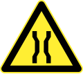
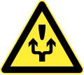
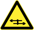
 Two-way traffic ahead
 -
 Pedestrian crossing ahead
 -
 Children ahead
 -
 Stoplights ahead
 -
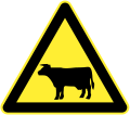 Animal area
 -
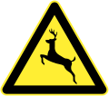 Wild animal area
 -
 Endangered wild animal area
 -
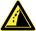
 Falling debris (Left)
 -
 Falling debris (Right)
 -
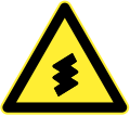
 Dangerous crosswinds
 -
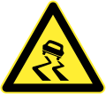 Slippery road
 -
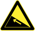
 Mountain road (Left)
 -
 Mountain road (Right)
 -
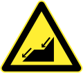
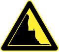
 Riverbank (Right)
 -
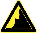
 Riverbank (Left)
 -
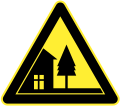 Cross-village road
 -
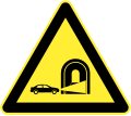
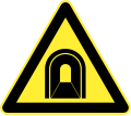 Tunnel ahead
 -
 Ferry
Ferry -
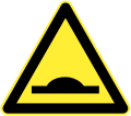
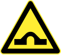 Hump bridge
 -
 Bumpy road
 -
 Bump
Bump -
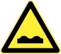
 Dip
Dip -
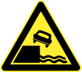
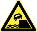
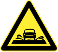 Flooded road
 -
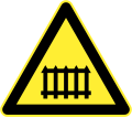 Railway crossing ahead (with safety barriers)
 -
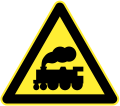 Railway crossing ahead (without safety barriers)
 -
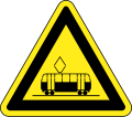 Warning for trams (Unofficial)
 -
 Railroad crossing
 -
 Railroad crossing (Korean version, used in borders near North Korea)
 -
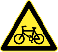 Cyclists
 -
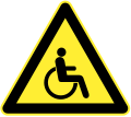 Wheelchairs ahead
 -
 Accident area
 -
 Slow
Slow -
 Turn left and/or right to detour
 -
 Turn left to detour
 -
 Turn right to detour
 -
 Caution
 -
 Roadworks ahead
 -
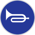
 Manual traffic control
 -
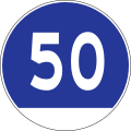
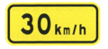 Advisory speed
 -
 Turn on lights for driving through tunnel
 -
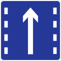
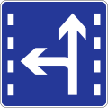
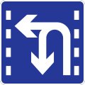
 Lane with tidal drive
 -
 Keep a safe distance
 -
 Crossroads with a dual carriageway
 -
 T-junction with a dual carriageway
 -
 Merging traffic on left
 -
 Merging traffic on right
 -

-
 Escape lane (Alt.)
 -
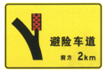
 2km to escape lane
 -
 2km to escape lane (Alt.)
 -
 1km to escape lane
 -
 1km to escape lane (Alt.)
 -
 500m to escape lane
 -
 500m to escape lane (Alt.)
 -
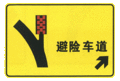
 Escape lane on right
 -
 Escape lane on right (Alt.)
 -
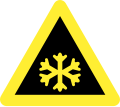 Snow ahead
 -
 Rain ahead
 -
 Fog ahead
 -
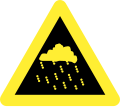
 Thunderstorm ahead
 -
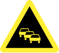 Traffic queues likely ahead


.gif)
.gif)
.gif)
.gif)
.gif)
.gif)


Prohibitory signs
[edit]-

-

-
 Yield to oncoming traffic
 -
 No entry for both vehicular traffic and pedestrians
 -
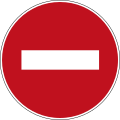 No entry for vehicular traffic
 -
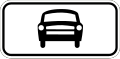
 No motor vehicles
 -
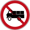 No freight vehicles
 -
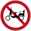 No electric scooters
 -
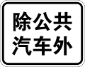
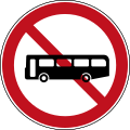 No buses
 -
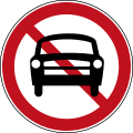
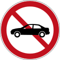 No cars
 -
 No cars (New)
 -
 No trailers
 -
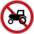 No tractors
 -

-
 No motorcycles
 -
 No freight vehicles and tractors
 -
 No bicycles
 -
 No horse-drawn vehicles
 -
 No passenger bikes
 -
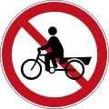 No freight bikes
 -
 No handcarts
 -
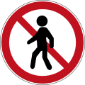 No pedestrians
 -
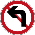 No left turns
 -
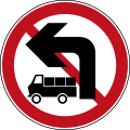 No left turns for freight vehicles
 -
 No right turns
 -
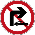 No right turns for cars
 -
 Do not proceed straight
 -
 No left and right turns
 -
 Do not proceed straight and no left turns
 -
 Do not proceed straight and no right turns
 -
 No U-turns
 -
 No overtaking
 -
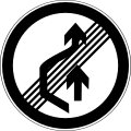 End of no overtaking area
 -
 No stopping
 -
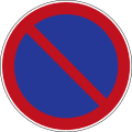 No parking
 -
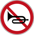 No honking
 -
 Maximum width
 -
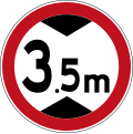 Maximum height
 -
 Maximum weight
 -
 Maximum weight per axle
 -
 Maximum speed limit
 -
 End of maximum speed limit
 -
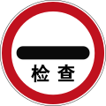 Security check
 -
 No vehicles carrying dangerous goods
 -
 Customs
 -
 Speed limit zone
 -
 End of speed limit zone
 -
 No parking zone
 -
 End of no parking zone
 -
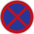
 No stopping zone
 -
 End of no stopping zone


.svg)
.svg)


Indicative signs
[edit]-
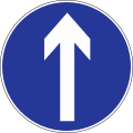 Proceed straight
 -
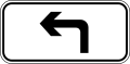
 Turn left
 -
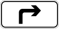
 Turn right
 -
 Proceed straight and/or turn left
 -
 Proceed straight and/or turn right
 -
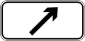
 Turn left and/or right
 -
 Keep to the right
 -
 Keep to the left
 -
 Proceed straight and turn left via ramp of Cloverleaf interchange
 -
 Proceed straight and turn right via ramp of interchange
 -

-
 One-way street to right
 -
 One-way street
 -
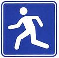
 Pedestrians only
 -
 Honking allowed
 -
 Minimum speed limit
 -
 Priority at junction
 -
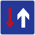 Priority over oncoming vehicles
 -
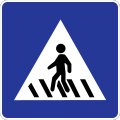 Crosswalk
 -
 Lane for turn right
 -
 Lane for right turns
 -
 Lane for proceeding straight
 -
 Lane for proceeding straight and right turns
 -
 Lane for proceeding straight and left turns
 -
 Lane for U-turns
 -
 Lane for U-turn and left turns
 -

-
-
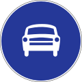
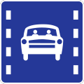
 Lane for automobiles
 -
 Bicycles only
 -
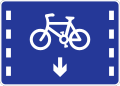 Lane for bicycles
 -
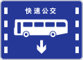 Lane for Bus rapid transit
 -
-
 Parking spot
 -
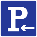 Parking spot to left
 -
 Parking place to right
 -
 Curb parking
 -
 U-turn


.svg)


Informational signs
[edit]-
 Directional sign with distance shown
 -
 Directional sign with distance shown and with lane divides
 -
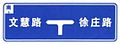
 T-junction directional sign with distance shown
 -
 Intersection with distance shown
 -
 Intersection with distance shown (Example 2)
 -
 Intersection from campus road with distance shown
 -
 Intersection
 -
 Intersection (Example 2)
 -
 Intersection from campus road
 -
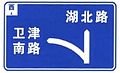
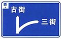
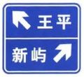
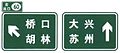
 Directional sign to roads given
 -
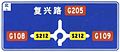
 Directional sign with distances to places given
 -
 Directional sign to places given
 -
 Ramp (Left)
 -
 Ramp (Right)
 -
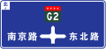
 T-junction
 -
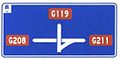
 Exits to left and right
 -
 Roundabout
 -
 National Highway interchange
 -
 Interchange
 -
 Exit (Left)
 -
 Exit (Right)
 -
 National Highway
 -
 Provincial Highway
 -
 County Highway
 -
 Rural Highway
 -
 Street sign
 -
 Vertically-written street sign
 -
 Street sign with directions and address numbers on either side
 -
 Distance to roads given
 -
 Place name
 -
 Place name with elevation
 -
 City limits
 -
 Road maintenance team
 -
 Road maintenance team (Example 2)
 -
 Hospital ahead
 -
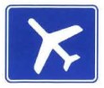 Low-flying aircraft
 -
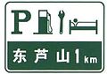
 Fuel station and car wash
 -
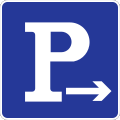
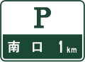
 Parking
 -
 Parking ahead
 -
 Emergency curb
 -

-

-
 Disabled parking
 -
 Sightseeing area and parking (Right)
 -
 Sightseeing area and parking (Left)
 -
-
 Rest area (left)
 -
 Rest area (right)
 -
 Alternative route to street desired
 -
 Alternative route to street desired
 -
 Alternative route for height-restricted vehicles
 -
 Cul-de-sac/dead end
 -
 3-lane road merges to 2 lanes
 -
 4-lane road merges to 3 lanes
 -
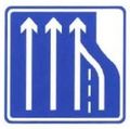
 2-lane road expands to 3 lanes
 -
 Traffic cameras ahead
 -
 Tunnel ends in 2500m
 -
 Tunnel ends in 2500m (left)
 -
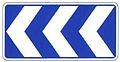
 Chevron (Left)
 -
 Chevron (Left)
 -
 Chevron with two arrows (Left)
 -
 Chevron with three arrows (Left)
 -
 T-junction both ways
 -
 Hazard marker or pass either side
 -
 Hazard marker (Right)
 -
 Hazard marker (Left)
 -
 Exit (Left)
 -
 Exit (Left)
 -
 Exit to highway (Left)
 -
 Exit to highway (Right)
 -
 National Highway sign without name below
 -
 Provincial Highway sign without name below
 -
 National Highway sign with name below
 -
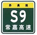 Provincial Highway sign with name below (S9 should not be Changjia (G1521))
 -
 Highway name
 -
 Distance to cities given
 -
 Distance to cities and highway given
 -
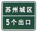 Area name with number of exits within
 -
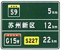 Distance to cities and highway given (example 2)
 -
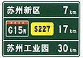 Distance to cities and highway given (example 3)
 -
 Next exit with road name only
 -
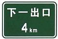
 Next exit with exit number only
 -
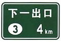
 Next exit with both exit number and road name
 -
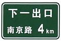
 Next exit in without either exit number and road name
 -
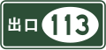 Exit number
 -
 Exit number (Left exit)
 -
 Highway Exit in 2km
 -
 Highway Exit in 1km
 -
 Highway Exit in 500m
 -
 Highway Exit
 -
 Highway Exit in 2km (Example 2)
 -
 Highway Exit in 1km (Example 2)
 -
 Highway Exit in 500m (Example 2)
 -
 Highway Exit (Example 2)
 -
 Highway Exit in 2km (Left)
 -
 Highway Exit in 1km (Left)
 -
 Highway Exit in 500m (Left)
 -
 Highway Exit (Left)
 -
 Highway Exit in 2km (Left) (Example 2)
 -
 Highway Exit in 1km (Left) (Example 2)
 -
 Highway Exit in 500m (Left) (Example 2)
 -
 Highway Exit (Left) (Example 2)
 -
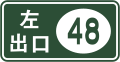
 Exit with exit number
 -
 Exit with exit number (Left)
 -
 Overhead highway sign plus exit
 -
 Overhead highway sign plus exit (Left)
 -
 National Highway
 -
 National Highway branch
 -
 Highway name
 -
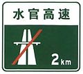
 National Highway ends in 2km
 -
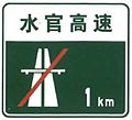
 National Highway ends in 1km
 -
 National Highway ends in 500m
 -
 Highway ends in 2km
 -
 Highway ends in 1km
 -
 Highway ends in 500m
 -
 National Highway ends
 -
 National Highway branch ends
 -
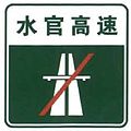 Highway ends
 -
 Highway ends in 200m; Reduce speed
 -
 Tune to 1620kHz for traffic information
 -
 Milestone with highway designation
 -
 Milestone with highway name
 -
 Milestone
 -
 Park to receive toll ticket
 -
 Danger of tailgating (i.e. high traffic zone); Keep your distance
 -
 Maintain a distance of 200m from vehicles ahead
 -
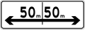
 0 meters marker
 -
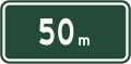 50 meters marker
 -
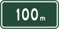 100 meters marker
 -
 Advisory speed in fog
 -
 Advisory speed in fog: 50 km/h
 -
 Emergency telephone
 -
 Emergency telephone in 400m (Left)
 -
 Emergency telephone in 400m (Right)
 -
 Emergency telephone on both sides in 500m
 -
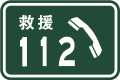
 Rescue telephone
 -
 Rescue telephone (Example 2)
 -
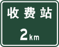 2km to toll gate
 -
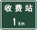 1km to toll gate
 -
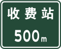 500m to toll gate
 -
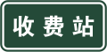 Toll gate
 -
 2km to toll gate that supports ETC
 -
 1km to toll gate that supports ETC
 -
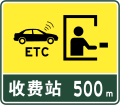 500m to toll gate that supports ETC
 -
 Toll gate that supports ETC
 -
 ETC lane to shoulder
 -
 ETC lane straight ahead
 -
 Weigh station with tolls
 -
 Gas station
 -
 Emergency curb
 -
 Full service area and restaurant in 2km
 -
 Full service area and restaurant in 1km
 -
 Full service area and restaurant exit
 -
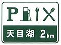
 Full service and lodging area in 2km
 -
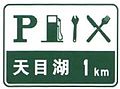
 Full service area and lodging in 1km
 -
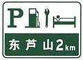
 Full service area and lodging exit
 -
 Service area exit
 -
 Service area exit (Example 2)
 -
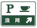
 Exit to parking and cafe in 1km
 -
 Exit to parking and cafe
 -
 Rest area exit
 -
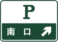
 Parking in 1km
 -
 Parking exit
 -
 Parking exit (Small)
 -
 Outdoor parking area
 -
 Indoor parking area
 -
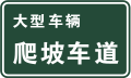 Climbing lane for large trucks
 -
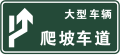 Climbing lane (Right lane) for large trucks
 -
 Climbing lane
 -
 Climbing lane ends
 -
 Weigh station in 2km
 -
 Weigh station in 1km
 -
 Weigh station in 500m
 -
 Weigh station exit
 -
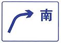
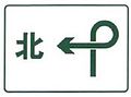
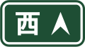
 Compass direction
 -
 Straight exit to compass direction given
 -
 Cloverleaf exit to compass direction given
 -
 Straight exit to compass direction given (Green)
 -
 Cloverleaf exit to compass direction given (Green)
 -
 Compass direction (Green)


.svg)
.svg)
.svg)


Tourist signs
[edit]-
 Distance to peak
 -
 Temple to right
 -
 Temple exit
 -
 Information
 -
 Hiking
 -
 Cable car
 -
 Camp
Camp -
 Campsite
 -
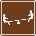 Playground
 -
 Horseback riding
 -
 Fishing
 -
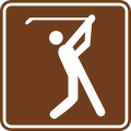 Golf
Golf -
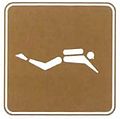 Diving
 -
 Swimming
 -
 Rowing
 -
 Site has snow
 -
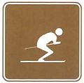 Skiing
 -
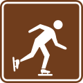 Ice-skating


Other signs
[edit]-
 Duration for traffic
 -
 Multiple durations for traffic
 -
 All traffic except for buses
 -
 Car traffic
 -
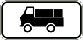 Truck traffic
 -
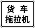 Truck and tractor traffic
 -
 Reserved for private use
 -
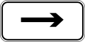
 One way (straight)
 -
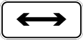 Two way
 -
 One way (right)
 -
 One way (left)
 -
 Keep left
 -
 Keep right
 -
 Turn right
 -
 Turn left
 -
 Distance (Straight)
 -
 Distance (Left)
 -
 Distance (Both ways)
 -
 Distance (Right)
 -
 Area inside road given
 -
 Distance marker
 -
 School
 -
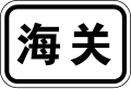 Customs
 -
 Accident
 -
 Collapse
 -
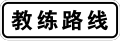 Driving practice route
 -
 Driving test route
 -
 School bus stop
 -
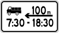 Trucks only in 100m in time given


Other advisory signs
[edit]-
 No drunk driving
 -
 No littering
 -
 Slow; sharp bend (Right)
 -
 Slow; sharp bend (Left)
 -
 Slow; sharp bend and dip (Right)
 -
 Slow; sharp bend and dip (Left)
 -
 Fasten your seatbelt
 -
 Large vehicles keep right
 -
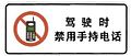 Do not use phones while driving
 -
 School bus stop


Retired signs
[edit]-
 Stop (Retired in 1999)

References
[edit]- ^ "Article 29". Convention on Road Signs and Signals (PDF). United Nations Treaty Series (in English, French, Chinese, Russian, and Spanish). Vol. 1091. Vienna. 8 November 1968. p. 27 – via United Nations Treaty Collection.
{{cite book}}: CS1 maint: location missing publisher (link)