Oederquart | |
|---|---|
.jpg) St. John's Church, Oederquart | |
 Coat of arms | |
Location of Oederquart
within Stade district 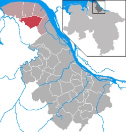 | |
 Location of Oederquart | |
 Oederquart  Oederquart | |
| Coordinates: 53°47′22″N 9°16′46″E / 53.789497°N 9.279327°E | |
| Country | Germany |
| State | Lower Saxony |
| District | Stade |
| Municipal assoc. | Nordkehdingen |
| Government | |
| • Mayor | Heinz Mahler |
| Area | |
• Total | 37.13 km2 (14.34 sq mi) |
| Elevation | 0 m (0 ft) |
| Population (2023-12-31)[1] | |
• Total | 1,006 |
| • Density | 27.09/km2 (70.17/sq mi) |
| Time zone | UTC+01:00 (CET) |
| • Summer (DST) | UTC+02:00 (CEST) |
| Postal codes | 21734 |
| Dialling codes | 04779 |
| Vehicle registration | STD |
| Website | www.oederquart.de |
Oederquart (German pronunciation: [ˈøːdɐkvaʁt]) is a municipality in the district of Stade, Lower Saxony, Germany.
It belonged to the Prince-Archbishopric of Bremen. In 1648 the Prince-Archbishopric was transformed into the Duchy of Bremen, which was first ruled in personal union by the Swedish and from 1715 on by the Hanoverian Crown. In 1823 the Duchy was abolished and its territory became part of the Stade Region.
References
[edit]- ^ "Alle politisch selbständigen Gemeinden mit ausgewählten Merkmalen am 31.12.2023" (in German). Federal Statistical Office of Germany. 28 October 2024. Retrieved 16 November 2024.

This Stade (district) location article is a stub. You can help Wikipedia by expanding it. |