Mont Lyall (Kerguelen)
| Mont Lyall | |
|---|---|
 Mont Lyall Sentinel-2 picture | |
| Highest point | |
| Elevation | 747 m (2,451 ft)[1] |
| Coordinates | 49°14′03″S 69°56′17″E / 49.23417°S 69.93806°E[1] |
| Geography | |
| Location | Kerguelen Islands, French Southern and Antarctic Lands |
| Climbing | |
| First ascent | Unknown |
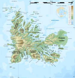
Mont Lyall is a mountain in the French Southern and Antarctic Lands. Located on the Courbet Peninsula, Grande Terre, Kerguelen Islands, it rises to a height of 747 metres (2,451 ft) above sea level.[1]
History
[edit]This mountain was named in 1874 during the Challenger expedition after David Lyall, the Assistant Surgeon on board HMS Terror who was in charge of the botanical collections.[2]
Edgar Aubert de la Rüe, who explored this area in February 1952, described Mont Lyall as an "outstanding and unmistakable mountain, being crowned by a kind of castle keep topped by two rocky needles resembling ridge turrets."[3]
See also
[edit]References
[edit]- ^ a b c Google Earth
- ^ Gracie Delépine, Toponymie des Terres Australes, éditions La Documentation française, Paris, 1973, p.219
- ^ Edgar Aubert de la Rüe, Deux ans aux îles de la Désolation. Archipel de Kerguelen, Julliard, 1954, p. 223

