Marócsa
You can help expand this article with text translated from the corresponding article in Hungarian. (January 2011) Click [show] for important translation instructions.
|
Marócsa | |
|---|---|
Village | |
 Marócsa Location in Hungary | |
| Coordinates: 45°54′54″N 17°48′52″E / 45.91500°N 17.81444°E | |
| Country | |
| County | Baranya County |
| District | Sellye |
| Government | |
| • Mayor | Jenőné Berta (Fidesz–KDNP) |
| • Term in office | since 2018 |
| Area | |
• Total | 11.38 km2 (4.39 sq mi) |
| Population (2022) | |
• Total | 161 |
| • Density | 14/km2 (37/sq mi) |
| Postal code | 7960 |
| Area code | 72 |
Marócsa is a village in Baranya county, Hungary.[1]
Names
[edit]In Croatian, the village has two names: Marača, used by residents of Drávakeresztúr, and Maroč, used in Felsőszentmárton.[2]
The origin of the name Marócsa is uncertain, but it may derive from a word in one of the South Slavic languages with a similar form.[3]
Gallery
[edit]-
 Aerial photo: Mecseknádasd - Palace
 -
 Szentegát - Biedermann-Palace from above
 -
 Mecsek Mountains, in the northern area of the county
 -
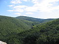
 Hills in the northeast


References
[edit]- ^ "Marócsa on the map of Hungary, location on the map, exact time". bw.maptons.com. Retrieved 2025-08-21.
- ^ "Podravina i Pomurje u ranom srednjem vijeku" (PDF). hrcak.srce.hr (in Croatian). Hrvatski znanstveni časopisi – Portal znanstvenih časopisa Republike Hrvatske. 2006. Retrieved 17 August 2025.
- ^ "Marócsa település leírása" (DOC). Magyar Nemzeti Atlasz (National Atlas of Hungary) (in Hungarian). University of Debrecen. Retrieved 17 August 2025.
Wikimedia Commons has media related to Marócsa.


This Baranya County–related article is a stub. You can help Wikipedia by expanding it. |