Hambühren
Hambühren | |
|---|---|
 Coat of arms | |
Location of Hambühren
within Celle district 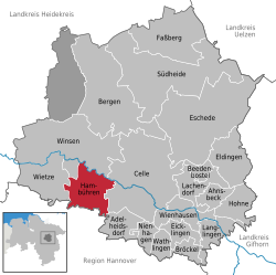 | |
 Location of Hambühren | |
 Hambühren  Hambühren | |
| Coordinates: 52°38′N 09°59′E / 52.633°N 9.983°E | |
| Country | Germany |
| State | Lower Saxony |
| District | Celle |
| Government | |
| • Mayor (2019–24) | Thomas Kranz[1] |
| Area | |
• Total | 56.7 km2 (21.9 sq mi) |
| Elevation | 36 m (118 ft) |
| Population (2023-12-31)[2] | |
• Total | 10,882 |
| • Density | 192/km2 (497/sq mi) |
| Time zone | UTC+01:00 (CET) |
| • Summer (DST) | UTC+02:00 (CEST) |
| Postal codes | 29313 |
| Dialling codes | 05084, 05143 (Oldau) |
| Vehicle registration | CE |
| Website | www.hambuehren.de |
Hambühren is a municipality in the district of Celle, in Lower Saxony, Germany. It is situated approximately 7 km (4.3 mi) west of Celle.
History
[edit]From the summer of 1944 to February 1945, a satellite camp of Bergen-Belsen concentration camp was in operation at Hambühren. Guarded by SS staff, around 400 female prisoners were forced to expand the former potash mine and to lay train tracks to it, work carried out by the company Hochtief. The tunnels were intended as an underground production site for Bremen plane manufacturer Focke-Wulf.[3]: 204
References
[edit]- ^ "Verzeichnis der direkt gewählten Bürgermeister/-innen und Landräte/Landrätinnen". Landesamt für Statistik Niedersachsen. April 2021.
- ^ "Alle politisch selbständigen Gemeinden mit ausgewählten Merkmalen am 31.12.2023" (in German). Federal Statistical Office of Germany. 28 October 2024. Retrieved 16 November 2024.
- ^ Knoch, Habbo, ed. (2010). Bergen-Belsen: Wehrmacht POW Camp 1940–1945, Concentration Camp 1943–1945, Displaced Persons Camp 1945–1950. Catalogue of the Permanent Exhibition. Wallstein. ISBN 978-3-8353-0794-0.
Towns and municipalities in Celle (district) | ||
|---|---|---|
 | ||
This Celle district location article is a stub. You can help Wikipedia by expanding it. |