Bronkow
Bronkow | |
|---|---|
Location of Bronkow
within Oberspreewald-Lausitz district 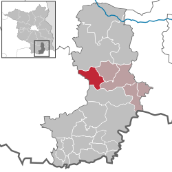 | |
 | |
| Location of Bronkow | |
 Bronkow  Bronkow | |
| Coordinates: 51°40′00″N 13°55′00″E / 51.66667°N 13.91667°E | |
| Country | Germany |
| State | Brandenburg |
| District | Oberspreewald-Lausitz |
| Municipal assoc. | Altdöbern |
| Subdivisions | 2 Ortsteile |
| Government | |
| • Mayor (2024–29) | Christian Pompsch[1] |
| Area | |
• Total | 38.21 km2 (14.75 sq mi) |
| Elevation | 129 m (423 ft) |
| Population (2023-12-31)[2] | |
• Total | 543 |
| • Density | 14.2/km2 (36.8/sq mi) |
| Time zone | UTC+01:00 (CET) |
| • Summer (DST) | UTC+02:00 (CEST) |
| Postal codes | 03205 |
| Dialling codes | 035435 |
| Vehicle registration | OSL |
| Website | www.amt-altdoebern.de |
Bronkow (German pronunciation: [ˈbʁɔŋko], Lower Sorbian: [ˈbrɔŋkɔw]) is a municipality in the Oberspreewald-Lausitz district, in southern Brandenburg, Germany.
Geography
[edit]Bronkow is one of the five municipalities in the Amt of Altdöbern. The municipality includes the districts (German: Ortsteile) of Lipten (Lower Sorbian: Libeśin) and Lug (Ług), as well as the inhabited communities (bewohnte Gemeindeteile) of Rutzkau (Cernjow) and Saadow (Žadow) and the residential areas of Amandusdorf and Forsthaus Lipten.[3]
History
[edit]From 1815 to 1945, Bronkow was part of the Prussian Province of Brandenburg.
From 1952 to 1990, it was part of the Bezirk Cottbus of East Germany.
Demography
[edit]
|
|
References
[edit]- ^ Landkreis Oberspreewald-Lausitz Wahl der Bürgermeisterin / des Bürgermeisters. Retrieved 3 July 2024.
- ^ "Alle politisch selbständigen Gemeinden mit ausgewählten Merkmalen am 31.12.2023" (in German). Federal Statistical Office of Germany. 28 October 2024. Retrieved 16 November 2024.
- ^ "Dienstleistungsportal der Landesverwaltung Brandenburg. Gemeinde Bronkow". 2021-09-30. Retrieved 2023-10-08.
- ^ Detailed data sources are to be found in the Wikimedia Commons.Population Projection Brandenburg at Wikimedia Commons
Towns and municipalities in Oberspreewald-Lausitz | ||
|---|---|---|
 | ||
This Brandenburg location article is a stub. You can help Wikipedia by expanding it. |