Bad Eilsen
You can help expand this article with text translated from the corresponding article in German. (June 2015) Click [show] for important translation instructions.
|
Bad Eilsen | |
|---|---|
 Prince's House in the spa park | |
 Coat of arms | |
Location of Bad Eilsen
within Schaumburg district 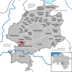 | |
 Bad Eilsen  Bad Eilsen | |
| Coordinates: 52°14′35″N 9°5′58″E / 52.24306°N 9.09944°E | |
| Country | Germany |
| State | Lower Saxony |
| District | Schaumburg |
| Municipal assoc. | Eilsen |
| Government | |
| • Mayor | Christel Bergmann (SPD) |
| Area | |
• Total | 2.46 km2 (0.95 sq mi) |
| Elevation | 133 m (436 ft) |
| Population (2023-12-31)[1] | |
• Total | 2,563 |
| • Density | 1,040/km2 (2,700/sq mi) |
| Time zone | UTC+01:00 (CET) |
| • Summer (DST) | UTC+02:00 (CEST) |
| Postal codes | 31707 |
| Dialling codes | 05722 |
| Vehicle registration | SHG |
| Website | www.bad-eilsen.de |
Bad Eilsen (West Low German: Ahlsen) is a municipality in the district of Schaumburg, in Lower Saxony, Germany. It is situated approximately 11 km (6.8 mi) southwest of Stadthagen, and 13 km (8.1 mi) southeast of Minden.
Bad Eilsen is also the seat of the Samtgemeinde ("collective municipality") Eilsen.
History
[edit]After World War II, Bad Eilsen was in the British Zone of Occupation. The British Air Force of Occupation (BAFO) was founded on 15 July 1945 and its headquarters were in Bad Eilsen until JHQ Rheindahlen was opened in 1954. The HQ was served by the airfield at RAF Bückeburg (now Bückeburg Air Base), which also served the nearby HQ of the British Army of the Rhine in Bad Oeynhausen.
References
[edit]- ^ "Alle politisch selbständigen Gemeinden mit ausgewählten Merkmalen am 31.12.2023" (in German). Federal Statistical Office of Germany. 28 October 2024. Retrieved 16 November 2024.
External links
[edit]| International | |
|---|---|
| National | |
This Schaumburg location article is a stub. You can help Wikipedia by expanding it. |